| |


Postás Cup
| Competition name | Postás Cup |
| Start date | 20070414 |
| End date | 20070415 |
| Country | Hungary |
| Race type | International |
| Nearest place or city | Szárliget/Tatabánya |
| Club/organizer | Postás-MATÁV SE |
| Number of competition days | 2 |
| Expected number of runners | 1000 |
| WRE event? | No |
| URL for event homepage | [Link] |
| Get list of related events: | - Within 100 kilometers and +/-14 days - Within 500 kilometers and +/-14 days - Within 500 kilometers any time - All events within +/-14 days |
| Corrections | Make corrections for this event  |
| URL for invitation | [Link] |
| Contact email address | |
| Contact phone number | +36/06-20-949-43-78 |
| Contact postal address | Riczel Zsuzsanna, 2145 Kerepes, Wéber Ede park 50. |
| Max distance from eventcentre to competitions | 0km |
| Latest entry date | 26th March 2007 |
| Entry fee (Euro) | 12 EUR/2 days |
| Typical accomodation fee, hotel (Euro) | 6 EUR |
| Typical accomodation fee, tent (Euro) | 2,5 EUR |
| Event description | Postas Cup is traditionaly one of Hungary's biggest and most well organised events. It is organised every year in various locations around Budapest, usually on well updated or brand new maps, by János Sötér, one of Hungary's best mapmakers. This is also the case with the 2007 edition. It will be organised with an evet center in Szárliget, easily reachable from Budapest by car with a short drive, but also with good public transport possibilities. The old map from "Zuppa Top", which was not used in the last 10 years, will be completly remaped. The event is usually attended by a large number of competitors from abroad, and as it also counts for the hungarian ranking, strong fields can be expected in all categories. Especially in the two elite classes where the event is also a part of the Hungarian Team's selections for WOC 2007! |
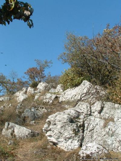
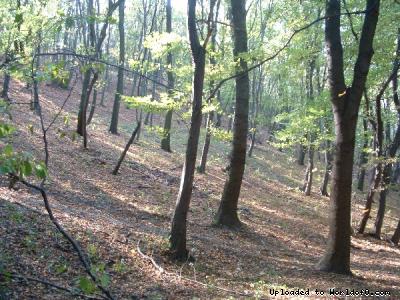
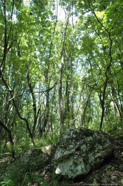
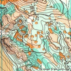
| Terrain description | The event takes place on and around Zuppa Top which is situated at 385m height on the Southern side of the Gerecse Mountain in the Transdanubian Range. The geology near the surdace show remains of an ancient sea, mostly limestone and dolomite. This creates the conditions underfoot and the relief. In places steep, rocky sides and flat tops, elsewhere small ridges and valleys follow each other, creating variety and a highly technical terrain. Vegetation cover includes oak and planted conifer forest, mixed with karst bush, open and semi open areas. Runnability of the clear felled areas, created by forestry operations, is variable. Zuppa Top was the scene of many events even prior to the use of coloured orienteering maps. Later the map has been updated and used many times, the last time in 1996. The Postás Cup used this area twice (1983, 1987), of which the year 1983 marked the advent of the first, unofficial World Cup. |
| Add to your calendar | 
 |
Map samples


Terrain and scenery images