| |


JWOC 2012 / GPS / Slovak Karst cup
| Competition name | JWOC 2012 / GPS / Slovak Karst cup |
| Start date | 20120712 |
| End date | 20120715 |
| Country | Slovakia |
| Race type | International |
| Nearest place or city | Kosice |
| Club/organizer | ATU Kosice |
| Region of country | Kosice |
| Number of competition days | 4 |
| Expected number of runners | 1000 |
| WRE event? | No |
| URL for event homepage | [Link] |
| Get list of related events: | - Within 100 kilometers and +/-14 days - Within 500 kilometers and +/-14 days - Within 500 kilometers any time - All events within +/-14 days |
| Corrections | Make corrections for this event  |
| URL for invitation | [Link] |
| Contact email address | |
| Contact phone number | +421 915 872 938 |
| Contact postal address | Klub orientacneho behu ATU Kosice, Watsonova 4, 040 01 Kosice, Slovakia |
| Max distance from eventcentre to competitions | 85 |
| Latest entry date | 10-06-2012 |
| Entry fee (Euro) | 35 |
| Typical accomodation fee, hotel (Euro) | 30-40 |
| Typical accomodation fee, tent (Euro) | 3 |
| Event description | GPS / Slovak Karst Cup is the biggest, favorites multiday o-event in Slovakia. It will be organized as accompanying event of Junior World Orienteering Championships 2012. |
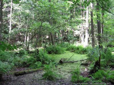
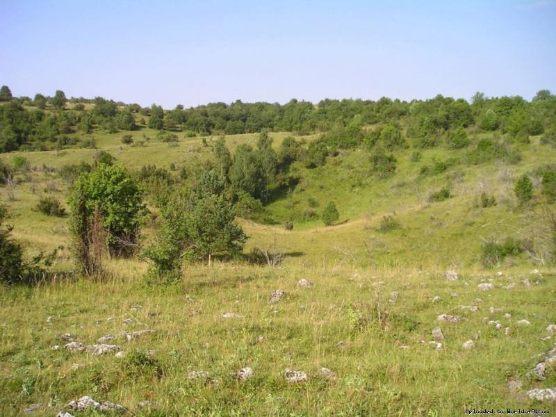
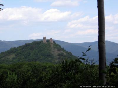
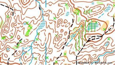
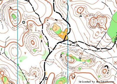
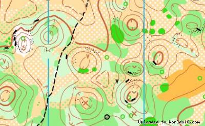
| Terrain description | All stages will be held at the same terrains as Junior World Orienteering Championships. E1- terrain reach for details originating from landslides and erosion of terrain. Appearance of marshes is typical for this terrain. Deciduous forest mostly, runability and visibility is very good, middle numerous of paths and tracks. E2- continental terrain, some parts with terrain details, deciduous forest mostly, middle numerous of paths and tracks. E3, E4 - karst plateau with numerous of depressions, part of terrain is open or semi-open area, different runability and visibility, middle numerous of paths and tracks. |
| Training possibilities | 11th July, 10:00-19:00 |
| Holiday activities,nature,hiking etc. | http://www.sopsr.sk/slovkras http://www.gemer.sk http://www.krasnohorskajaskyna.sk http://www.hradkrasnahorka.sk http://www.betliar.eu http://www.slovensky-raj.sk http://spisskyhrad.sk http://www.kosice.sk |
| Street address of navigation point | 48°46´07" 21°07´00" |
| URL for results | [Link] |
| URL for map with course | [Link] |
| URL for photos from event | [Link] |
| URL for full race report | [Link] |
| Live results available? | Yes |
| Direct URL for live results | [Link] |
| Live GPS tracking available? | No |
| Live TV available? | No |
| Add to your calendar | 
 |
Map samples
Terrain and scenery images