| |


Slavonija & Baranja OPEN
| Competition name | Slavonija & Baranja OPEN |
| Start date | 20110709 |
| End date | 20110710 |
| Country | Croatia |
| Race type | International |
| Nearest place or city | Beli Manastir |
| Club/organizer | OK MEDJIMURJE |
| Region of country | Slavonija & Baranja County |
| Number of competition days | 2 |
| Expected number of runners | 500 |
| WRE event? | No |
| URL for event homepage | [Link] |
| Get list of related events: | - Within 100 kilometers and +/-14 days - Within 500 kilometers and +/-14 days - Within 500 kilometers any time - All events within +/-14 days |
| Corrections | Make corrections for this event  |
| URL for invitation | [Link] |
| Contact email address | |
| Contact phone number | 00385912503569 |
| Max distance from eventcentre to competitions | 30 |
| Latest entry date | 04.07.2011 |
| Entry fee (Euro) | 10 eur/ race |
| Typical accomodation fee, hotel (Euro) | 20 eur |
| Typical accomodation fee, tent (Euro) | free |
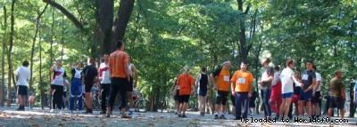
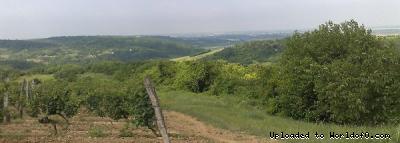
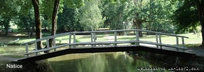
| Event description | For the first time in this part of the Croatia we organize orienteering competition. Just after WMOC, only 70 kilometers from Pécs on the way to CROATIA OPEN we offer you 3 races in two days: 1st stage in Nasice - Stage one of PWT Trawel Danube tour - Croatian Sprint cup. 2nd stage in Beli Manastir - Croatian Sprint Cup. 3rd stage at the Zlatno Brdo near Beli Manastir - Croatian Championship in middle distance. Join us in a relaxing atmosphere and good orienteering company! |
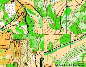
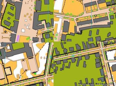
| Terrain description | Stage 1 : City park with a decorated park infrastructure and urban areas. Stage 2 : City center, street network, schoolyards. Stage 3 : forest areas difficult to run, open and semi-open areas with overgrown meadows, vineyards, mildly wavy terrain. |
| Live results available? | No |
| Live GPS tracking available? | No |
| Live TV available? | No |
| Add to your calendar | 
 |
Map samples

Terrain and scenery images